- Mount Agung is Bali's highest point, at approximately 3,031 metres above sea level.
- It is an active stratovolcano in Karangasem Regency, East Bali.
- Balinese Hindus regard it as the most sacred mountain on the island.
- Pura Besakih, the Mother Temple of Bali, sits on its southwestern slope.
- Major eruptions took place in 1843, 1963–64 and 2017–2019.
- Two main trekking routes lead up the mountain, from Besakih and Pasar Agung.
- Climbs run at night with a licensed guide to reach high ground for sunrise.
- The dry season, from April to October, offers the clearest views.
- The summit sits roughly 20 km from The Seed in Candidasa.
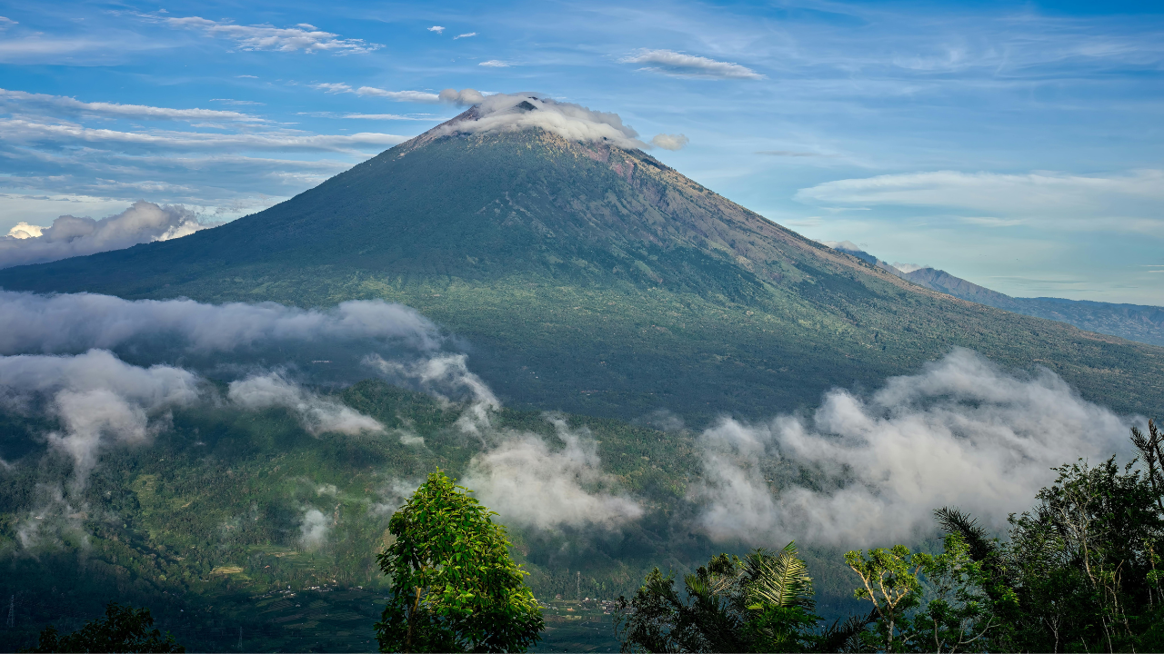
Mount Agung, known locally as Gunung Agung or "Great Mountain", is an active stratovolcano in Karangasem Regency, East Bali, and the highest point on the island at approximately 3,031 metres above sea level.
Balinese Hindus regard it as the most sacred mountain on Bali, the seat of the gods and a fragment of the cosmic Mount Mahameru, and Pura Besakih, the island's Mother Temple, sits on its southwestern slope. The volcano last erupted between 2017 and 2019, and its 1963 eruption ranks among the most significant volcanic events of the 20th century.
The mountain sets the direction Balinese homes and temples face, and it feeds the rivers and springs that water the farmland below.
For guests staying in East Bali, Mount Agung is both a backdrop and a destination. This guide covers how the volcano formed, the legends attached to it, its place in Balinese religious life, its eruption history, and what it takes to hike Mount Agung to the crater rim or the summit.
How Mount Agung Formed
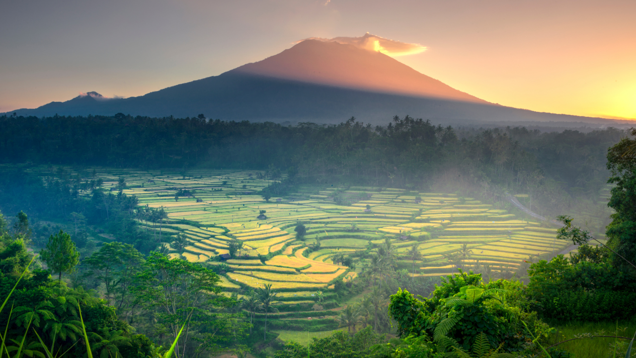
Mount Agung belongs to the Sunda Arc, a chain of volcanoes running from Sumatra through Java, Bali and Lombok. The chain exists because the Indo-Australian Plate slides beneath the Eurasian Plate to the south of the islands. As the descending plate sinks into the mantle, it releases water that lowers the melting point of the surrounding rock. The resulting magma rises toward the surface and feeds the volcanoes strung along the arc.
Agung is a stratovolcano, built up over thousands of years from alternating layers of lava, ash and rock fragments. That layered construction gives it the steep, symmetrical cone visible from the coast. Stratovolcanoes tend to produce explosive eruptions, because their magma is thick and traps gas until pressure releases it suddenly. Agung's eruption history follows that pattern, with long quiet periods broken by short, violent episodes.
The same eruptions that make the mountain dangerous also made East Bali fertile. Successive ash falls left mineral-rich volcanic soils across the lower slopes, supporting the farming communities, orchards and spice gardens found throughout Karangasem today. Rainfall captured on the upper slopes drains into springs and rivers that supply villages and the water temples linked to them. Geologically and agriculturally, the region exists in its current form because of the volcano.
The Origin Story: Pasupati and Mount Mahameru
Balinese tradition gives the mountain a very different origin. According to stories preserved in palm-leaf manuscripts, including the Babad Pasek chronicle, the islands of Java and Bali were once unstable, drifting and rocking on the sea. The god Pasupati, a manifestation of Shiva, set out to steady them. He took the peak of Mount Mahameru, the cosmic mountain at the centre of the Hindu universe, and carried it east.
Fragments broke away along the journey and became the volcanoes of Java. When Pasupati reached Bali, he divided what remained. The larger portion became Mount Agung; the smaller became Mount Batur, in Kintamani. With the two mountains in place, the island settled.
Pasupati then sent his children to watch over Bali. Hyang Putrajaya took his seat on Mount Agung, Dewi Danu, goddess of the lake, took Lake Batur, and Hyang Gnijaya settled on Mount Lempuyang, east of Agung. Together they were charged with the protection and prosperity of the island. Balinese Hindus still address the deity of the mountain by an honorific title, Ida Bhatara Lingsir Giri Tohlangkir, the Elder Deity of Mount Agung.
Other stories circulate across Karangasem. One tells of the god Indra losing a sacred keris on the summit. Others describe caves on the slopes said to lead deep into the mountain. These local legends vary from village to village, but they share one idea, that Mount Agung is a dwelling place of the gods, and the island's balance depends on it.
The Cultural Significance of Mount Agung
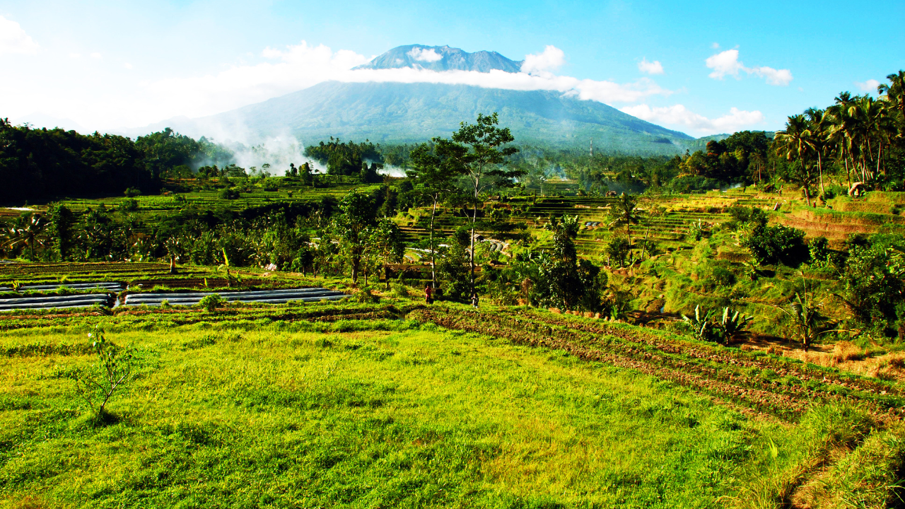
Balinese orientation runs along two poles, which is kaja, toward the mountain, and kelod, toward the sea. Kaja is associated with purity and the divine; kelod with the lower world. Across most of the island, Agung marks kaja.
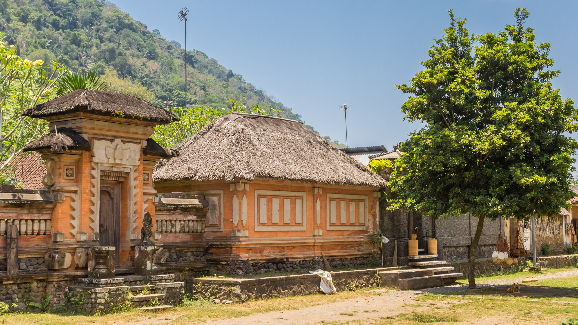
That axis shapes architecture. In a traditional family compound, the house temple sits in the kaja corner, closest to the mountain, while kitchens and service areas sit toward kelod. Villages follow the same logic, with the village temple of origin placed on the upper side and the temple of the dead placed toward the sea. Balinese Hindus, including those living off the island, face east or northeast toward Agung when they pray.
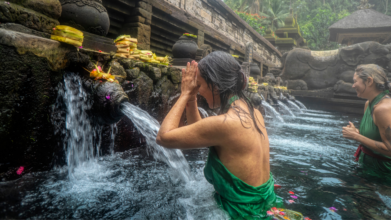
The mountain also sets the scale of Bali's largest ceremonies. Two island-wide rituals of purification take place at Pura Besakih on its slopes, with Panca Bali Krama, held once every ten years, and Eka Dasa Rudra, held once every hundred years, when the Balinese Saka calendar turns to a new century. Each year, during the ceremony of Ida Bhatara Turun Kabeh, meaning "the gods descend together", Balinese Hindus believe the deities come down from the mountain to Besakih to bless the island. The ceremony runs for 21 days, and the mountain closes to climbers for the duration.
Pura Besakih: The Mother Temple
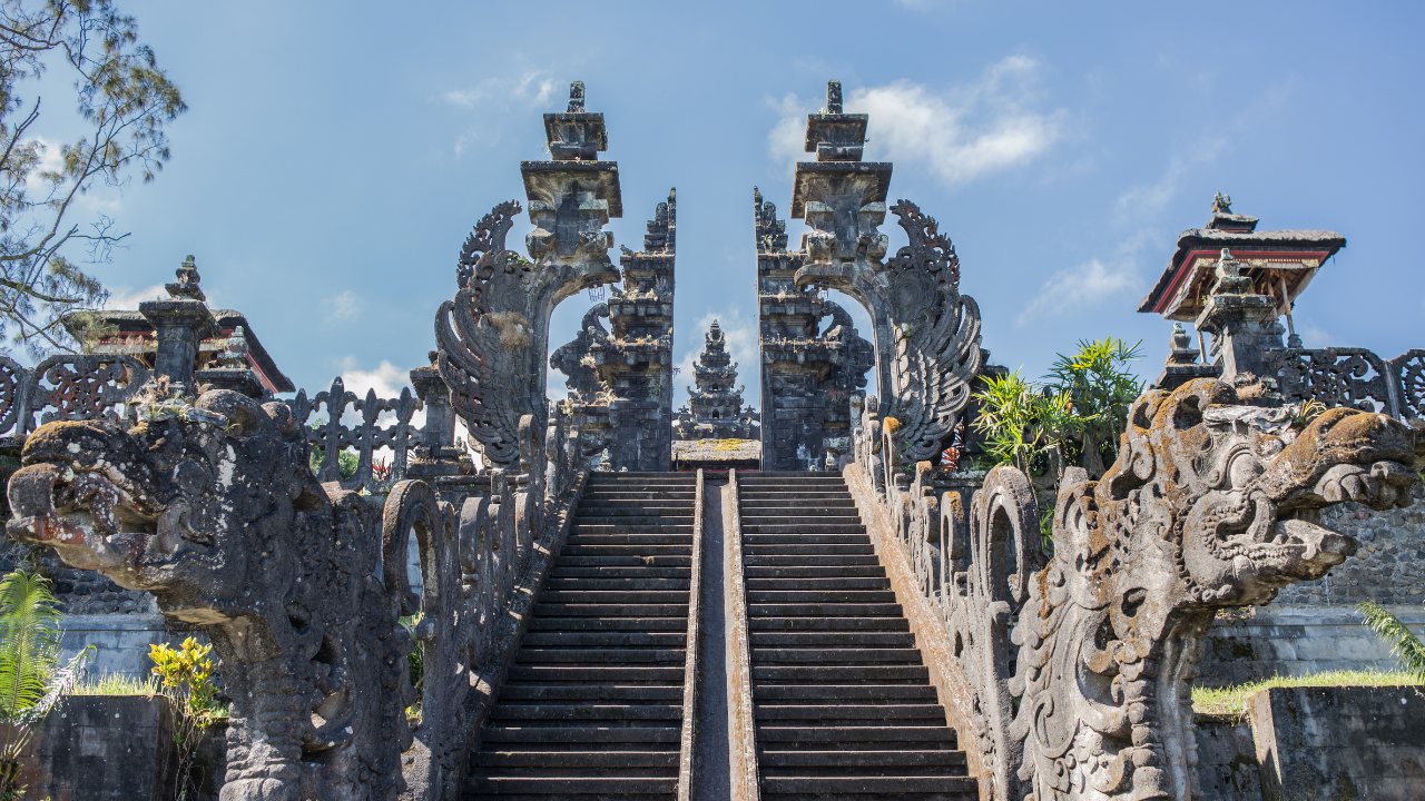
Pura Besakih sits on the southwestern slope of Mount Agung at roughly 900 to 1,000 metres above sea level. Known as the Mother Temple of Bali, it is the largest and most important temple complex on the island, made up of more than 20 temples spread across terraces on parallel ridges. Records point to Besakih serving as the central temple of Balinese Hinduism since at least the 15th century, and its origins as a sacred site reach back considerably further.
At the centre stands Pura Penataran Agung, the principal temple, set on rising terraces that climb toward the mountain. Its multi-tiered meru shrines, with their stacked thatched roofs, mirror the shape of Mahameru, the mythological mountain that Agung represents. Each of Bali's major clans and regions maintains its own temple within the complex, which makes Besakih a working centre of worship for the whole island and a place where ceremonies take place throughout the year.
Visitors can enter the outer courtyards with a sarong and sash, which are available at the entrance. Local guides at Besakih explain the layout and the role of each temple, and the site rewards an unhurried visit, ideally in the morning when the summit is most likely to be clear above the temple roofs. Besakih is also the starting point for the longest of the trekking routes to the summit.
Mount Agung's History Written in Eruptions
1843
The earliest eruption of Mount Agung with a written record took place in 1843. The account comes from Heinrich Zollinger, a Swiss naturalist who travelled through Bali and Lombok in the 1840s. He described the mountain coming back to life after having been dormant for a long time. Earthquakes came first and were felt in the surrounding villages. Then the volcano threw out ash, sand and stones.
Modern geology has shown how large the 1843 event was. In a 2015 study, volcanologists mapped the ash, mudflow, pyroclastic flow and lava deposits around Agung, going back roughly 5,000 years. They found that the 1843 eruption was more energetic than the 1963 eruption, which is still remembered as one of the most destructive in Bali's history. The same research found that Agung has been more active over the past few hundred years than its average over the past few thousand.
1963–64
Activity resumed in February 1963, at a moment of deep significance for Bali. Religious leaders had scheduled Eka Dasa Rudra, the centennial purification ceremony, at Pura Besakih for that period. As preparations went ahead, the mountain grew more active, and in March 1963 it erupted with great force. Pyroclastic flows swept down its slopes and later rains turned ash deposits into lahars, mudflows that buried villages. More than 1,100 people died, with many estimates placing the toll closer to 1,500. The ash cloud reached the stratosphere and lowered average temperatures across the Northern Hemisphere by a fraction of a degree in the following year.
Lava flows came within a short distance of Pura Besakih and stopped. Many Balinese read that as a sign that the gods had shown their power while sparing the holiest temple on the island. Eka Dasa Rudra was held again in 1979, completing the ceremony interrupted 16 years earlier.
2017–2019
In September 2017, rising seismic activity led Indonesia's Center for Volcanology and Geological Hazard Mitigation (PVMBG) to raise the alert to its highest level, and more than 140,000 people left the area around the mountain. Eruptions began in November 2017, sending ash several kilometres into the air and briefly closing Bali's international airport. Smaller eruptions continued into 2019 before activity settled.
How to Hike Mount Agung
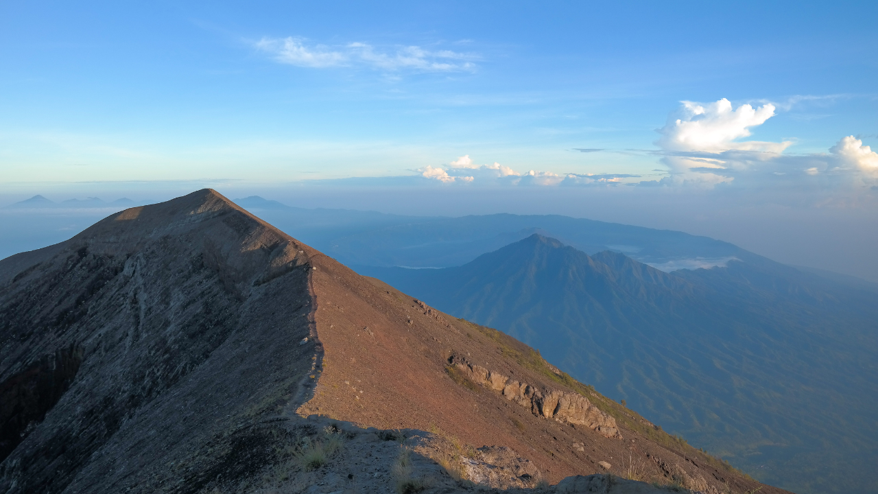
To hike Mount Agung is a serious undertaking. It is the hardest of Bali's commonly climbed peaks, with steep gradients, loose volcanic ground and a large elevation gain packed into a single night. Two main trekking routes lead up the mountain, both starting from temples and both timed to reach high ground for sunrise.
The Besakih Route
The Besakih route is the classic climb to the true summit. It starts near Pura Besakih at roughly 1,000 metres above sea level and climbs around 2,000 metres to the peak, beginning in forest and finishing on exposed rock along a narrow ridge. Climbers usually set off before midnight to reach the top for sunrise.
- Start point: Pura Besakih, approx. 1,000m above sea level
- Finish: true summit, approx. 3,031m above sea level
- Ascent: 6–7 hours
- Descent: 4–5 hours
- Total: 10–12 hours
- Typical trail start: 11pm
- Suited to: experienced, very fit hikers
The Pasar Agung Route
The Pasar Agung route starts higher, at Pura Pasar Agung near the village of Sebudi on the southern slope, at around 1,500 metres above sea level. It is shorter and more direct, climbing over rock slabs to the crater rim at roughly 2,900 metres. The rim looks straight down into the crater and across to the summit. Some guides offer an extension from the rim to the true summit, which adds several hours and significant difficulty.
- Start point: Pura Pasar Agung, approx. 1,500m above sea level
- Finish: crater rim, approx. 2,900m above sea level
- Ascent: 3–4 hours
- Descent: 2–3 hours
- Total: 6–8 hours
- Typical trail start: 2am
- Suited to: fit hikers wanting a sunrise climb with a shorter total day
What the Climb Involves
Both trekking routes are walked in the dark by headtorch for most of the ascent. The final sections are steep enough that hands come into play on rock, and the descent on loose scree is often harder on the legs than the climb. Temperatures at the top drop sharply before dawn, and wind on the exposed ridge adds to the chill.
A practical kit list for any group planning to climb Mount Agung:
- Hiking boots with good grip
- Headtorch with spare batteries
- Warm layers, a windproof jacket, gloves and a hat
- 2–3 litres of water per person
- High-energy snacks
- Trekking poles for the descent
- Sarong and sash for temples along the route
When to Climb
The dry season, from roughly April to October, offers the best chance of clear skies and firm trails. In the wet season, trails become slippery and cloud often covers the summit at sunrise. Climbs also follow the ceremonial calendar: the mountain closes for around four weeks each year during Ida Bhatara Turun Kabeh at Besakih, and for other major ceremonies as announced by local temple authorities. In 2026, that closure ran from 28 March to 24 April.
Is Mount Agung Safe to Climb?
Whether Mount Agung is safe to climb on a given date depends on three things, including the volcano's official alert level, the ceremonial calendar and the fitness of the group.
Alert level: PVMBG monitors Agung continuously and publishes its status on a four-level scale, from Level I (Normal) to Level IV (Awas). At the time of writing, the volcano sits at Level I. When the level rises, PVMBG sets exclusion zones around the crater, and climbing stops. Current status is published on the MAGMA Indonesia platform, and guides and The Seed's concierge team check it ahead of every trek.
Guides: Climbs run with a licensed local guide. Guides know the routes in darkness, read the weather on the upper slopes, lead the offerings made at shrines along the way, and turn groups around when conditions change.
Fitness: Both routes involve long, steep ascents on uneven ground at night. Climbers should be comfortable walking uphill for several hours and confident on loose terrain. Guests with knee or heart conditions should speak with a doctor before booking.
Respect for the mountain: Mount Agung is a sacred site. Guides set the rules on the trail, and climbers follow them: modest clothing near temples, quiet conduct at shrines, and a clean trail with all rubbish carried down.
For guests who want a sunrise volcano trek, The Seed offers guided Mount Batur treks as part of its Outdoor Adventures programme.
Common questions
Where is Mount Agung located?
Mount Agung is located in Karangasem Regency in East Bali. At approximately 3,031 metres above sea level, it is Bali's highest mountain and its highest volcano. It is the dominant feature of the eastern landscape and can be seen from the beaches of Candidasa, about 20 km south of the summit.
Why is Mount Agung considered sacred?
Mount Agung is considered sacred because Balinese Hindus believe it is the home of the gods and a piece of Mount Mahameru, the mountain at the centre of the Hindu universe. Besakih Temple, the Mother Temple of Bali, stands on its southwestern slope. Smaller shrines are scattered across the mountain, from the villages at its base up to the high trails.
What local customs apply when visiting Mount Agung?
Visiting Mount Agung means entering a place where people actively worship, so local customs apply on the trails and at the temples. Visitors wear a sarong and sash at Besakih Temple and the shrines along the routes, speak quietly near offerings, and follow the guide's lead at prayer points. Tourists who respect sacred sites in these ways are welcome on the mountain all year, except during ceremonial closures.
Is it safe to climb Mount Agung?
Climbing Mount Agung is safe when the volcano's alert level is at Level I (Normal), the mountain is open between ceremonies, and the group follows the safety guidelines set by a licensed guide. Indonesia's volcano monitoring agency (PVMBG) monitors the volcano around the clock and publishes the current alert level on the MAGMA Indonesia site. Safety on the trail also depends on fitness and careful preparation, because both routes climb steep, loose ground in the dark.
Has Mount Agung had major eruptions?
Mount Agung has three major eruptions on record: 1843, 1963–64 and 2017–2019. The 1963 eruption killed more than 1,100 people and sent ash high into the upper atmosphere. Scientists have studied the deposits it left and found that the 1843 eruption was even more powerful. PVMBG still monitors the volcano closely, and climbing pauses whenever the alert level rises.
What should I wear and bring to hike Mount Agung?
Sturdy hiking boots with good grip are essential, because the upper slopes are loose volcanic rock and scree. Wear layered clothing as temperatures drop sharply before dawn, and the exposed summit ridge is windy. Bring a headtorch with spare batteries, 2–3 litres of water, high-energy snacks, trekking poles for the descent, and a sarong for the temples along the way.
When is the best time of year to climb Mount Agung?
The best time to climb Mount Agung is the dry season, from roughly April to October, when the weather is more settled, skies are clearer at sunrise and the trails are firmer. From November to March, rain makes the trails slippery and cloud often covers the summit. All year round, cloud tends to gather around the peak by late morning, which is why treks are timed for sunrise.
Can I explore the area around Mount Agung without hiking?
Guests can explore the area around Mount Agung on day trips arranged by the concierge team. Options include Besakih Temple, Pura Lempuyang, where the summit is framed by the temple's split gate, and the royal water palaces of Tirta Gangga and Taman Ujung. Each trip takes in the volcanic landscape and the nature of East Bali, with the mountain in view much of the way.
Tell us what you have in mind and we will come back with what the estate can hold.
Plan your vacation
Family holidays, reunions, and quiet time together, by the sea in Candidasa.
Learn more →
Host your retreat
A venue for facilitators, with a full hospitality team behind every session.
Learn more →